Latest: Gabrielle approaches NZ (+25 Maps)
12/02/2023 9:53am
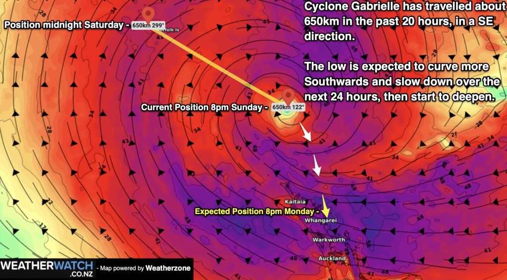
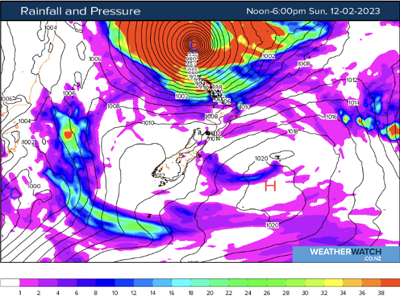
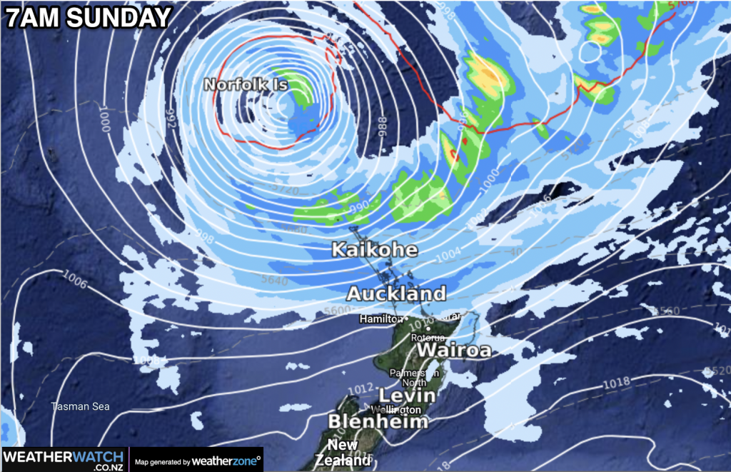
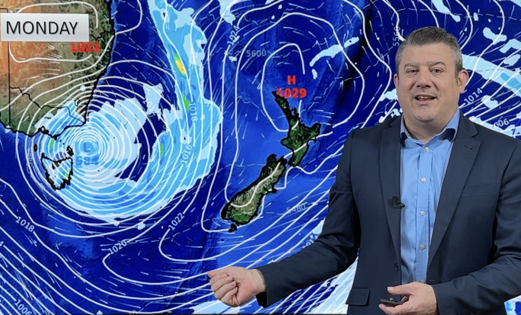
The effects of Cyclone Gabrielle will be felt across much of the North Island today, especially later in the day, as the outskirts of the storm system move in. It’s a different picture in the south however, thanks to a stubborn ridge of high pressure enabling a mainly fine and sunny Sunday ahead for many regions.
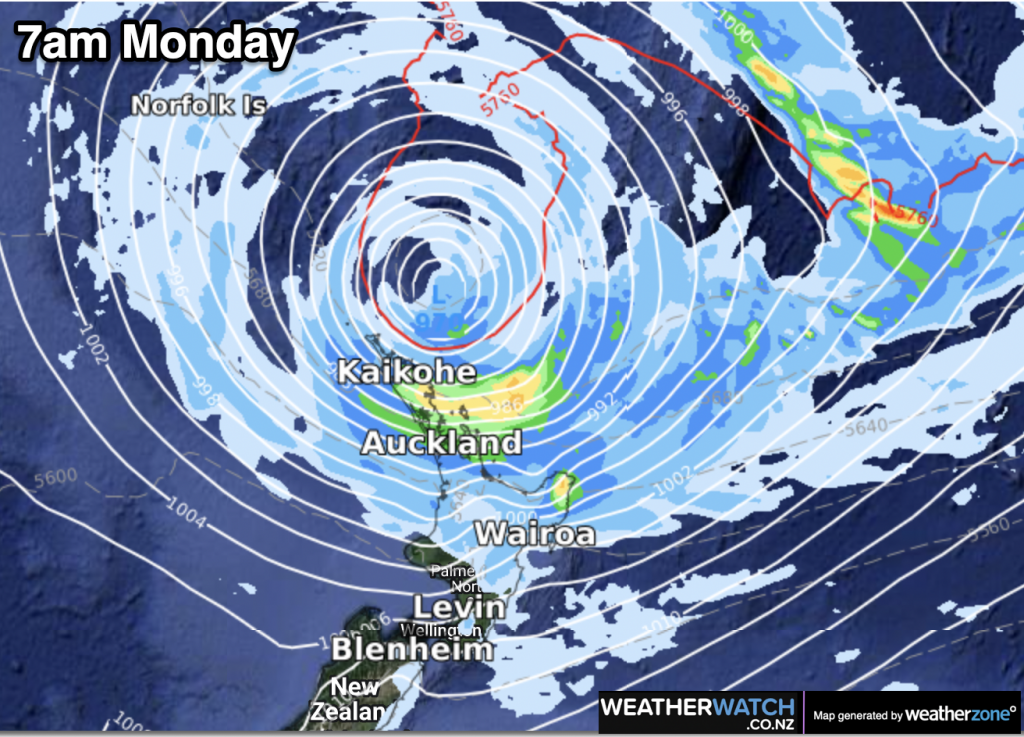
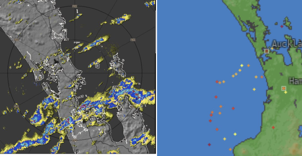
Northland, Auckland and the Coromandel will bear the brunt of the bad weather today as strong easterly winds rise to gale force at times and periods of heavy rain set in, particularly in the east. Fresh gusty easterlies are expected to develop over the remainder of the North Island throughout the day, with rain, more patchy in nature, developing across central regions and about the east coast. In the west; Taranaki, Whanganui, Kapiti and Wellington should all remain mostly fine, with increasing high cloud and temperatures of around 20 degrees.
A mostly cloudy day for the Tasman district, drizzly in Marlborough and fresh, gusty north-easterlies along the east coast are the only real knocks on the South Island’s Sunday weather, with the vast majority of regions in line for a mostly sunny and settled day ahead. A few isolated showers however may pop up about inland Otago and Southland during the afternoon. Pleasant temperatures for most, particularly inland, ranging between 18-23 degrees.
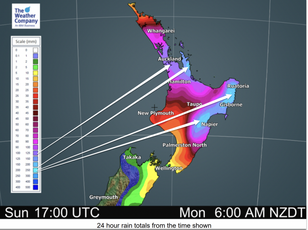
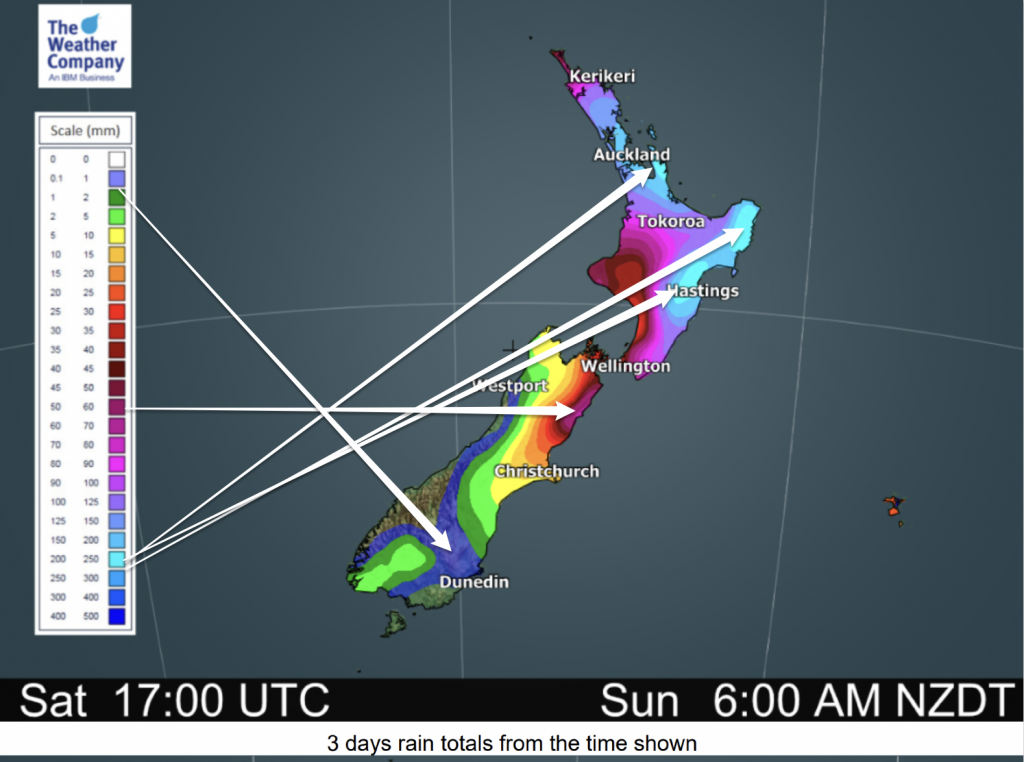
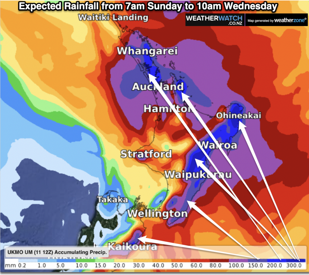
Please note – in the wind maps above the white lines are just a very loose guide for to match colour with the key (especially for those who are colour blind). The final key (strongest winds over 119km/h) is very general – we do NOT expect winds over 200km/h despite that arrow on Monday evening pointing to that box. We expect gusts generally 130 to 150km/h in the peak areas. As always, if you’re unsure – check your local forecast + your local MetService warning. The maps are just a visual guide to show areas with the strongest winds.
SPECIAL VIDEO TODAY:
We have another video update on Cyclone Gabrielle early this afternoon, with latest tracking and we explain what it means to go from a tropical cyclone to an extra-tropical storm.
COMPARE THE MODELS
What do the computer models show for the tracking? View here with interactive maps and animation courtesy of Predictwind.com: www.weatherwatch.co.nz/maps-radars/wind/wind-forecast
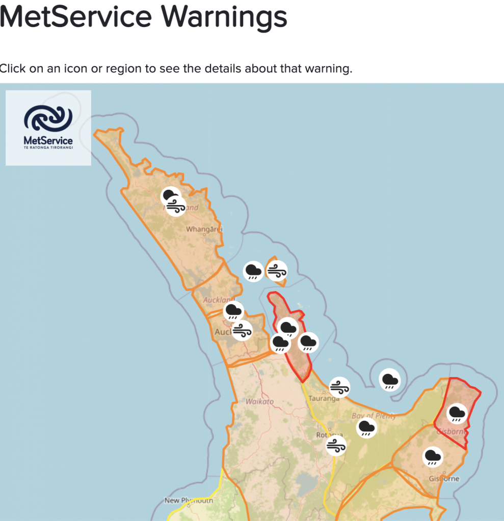
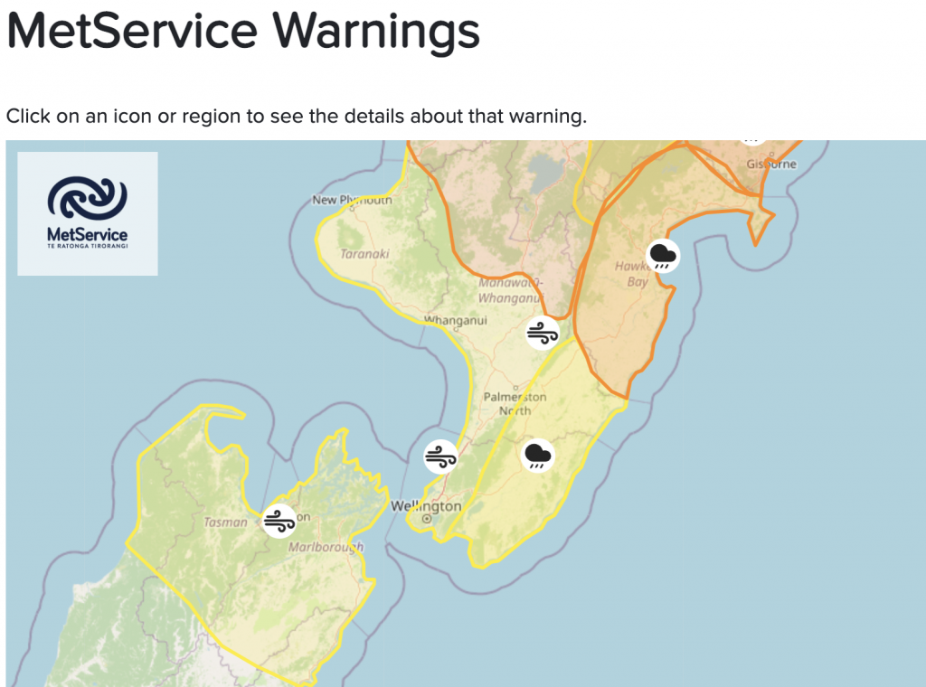
METSERVICE WARNINGS & OTHER ALERTING
All current official MetService warnings can be found here – including watches for further warnings.
We also recommend Lert.info if you want to get additional warnings from all various authorities – specific to your local part of NZ.

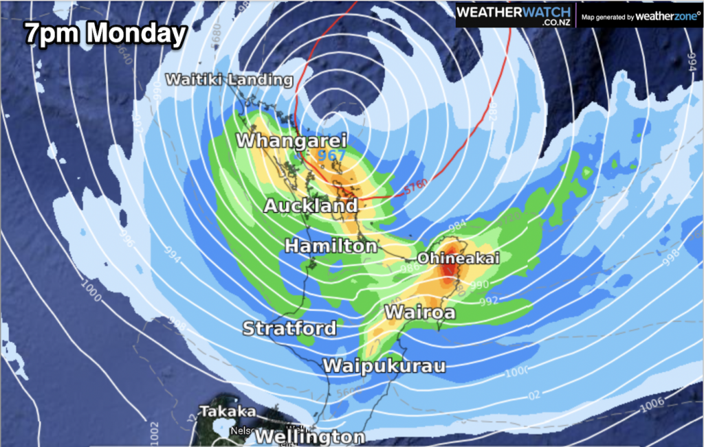
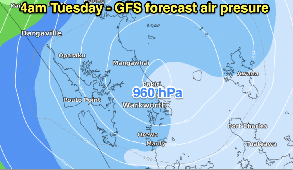
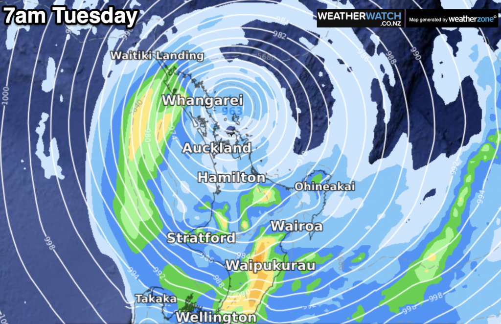
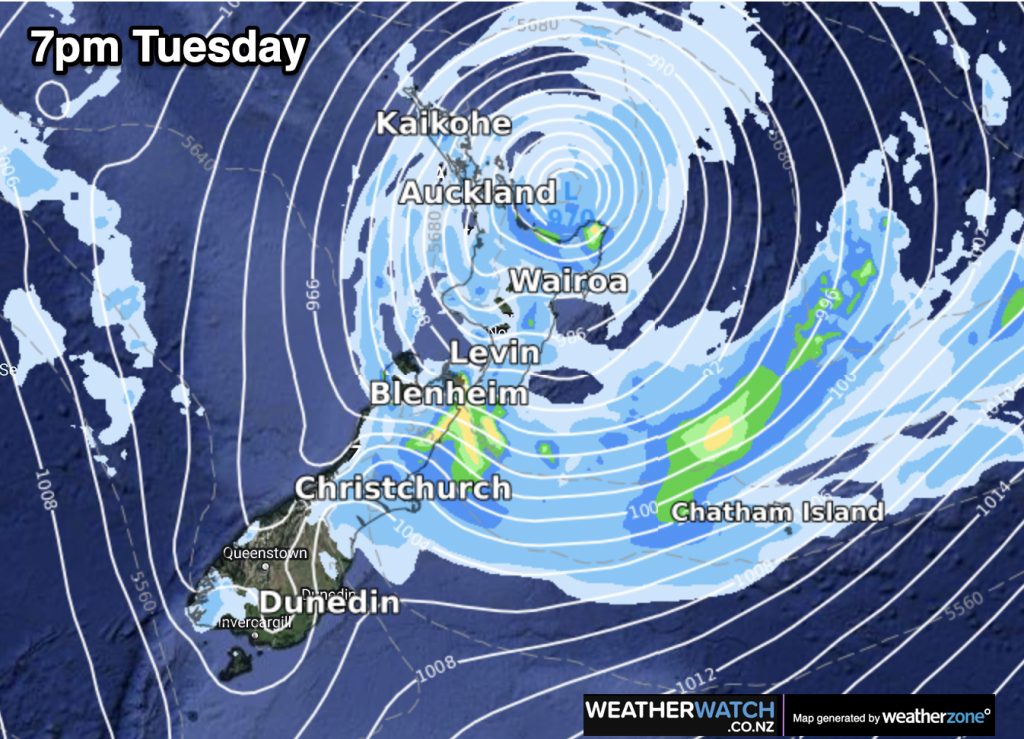
- More details early afternoon in our next Special Video Update
- Story by Jono Hartland and Philip Duncan
- WeatherWatch.co.nz and RuralWeather.co.nz


Add new comment
Andy on 12/02/2023 9:24am
Typically a 1 hectopascal drop in atmospheric pressure results in about a 1 cm rise in sea level.
And it’s 966 millibar in the storm centre vs say 1008 as a standard so by my calculation that’s 42cm height increase in sea level?
Reply
WW Forecast Team on 12/02/2023 9:39am
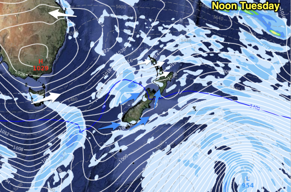
Hi Andy, yes that’s what MetService is saying – around half a metre above normal height. The Australian model is picking 957hPa near Great Barrier Island on Tuesday morning, the rest are forecasting in the 960 range.
– WW
Reply
mel on 12/02/2023 8:27am
What does ‘deepen’ mean? Intensify? Extend in area?
Reply
WW Forecast Team on 12/02/2023 8:33am
Hi Mel, yes precisely – it means the low’s air pressure will drop again, causing the storm to intensify and produce more severe weather further out from the centre. It looks to deepen late Monday and Tuesday morning, before weakening back to today’s level by Wednesday morning.
– WW
Reply
JULIO MONROY on 12/02/2023 7:54am
Great explanation, it was really clear and it has all the information we need, exceeds expectations.
Reply
Divvy on 12/02/2023 3:45am
Great updates. Appreciate you trying to keep us all safe. Be safe. Thank you
Reply
Christopher Randal on 12/02/2023 3:00am
For the cyclone to move SE the blocking high has to collapse (or move East). If it doesn’t, will the cyclone move down the Tasman Sea, joining up with the small low that is there (showing on the Metservice surface analysis)?
Reply